Tools for Emergency Managers: What is GIS?
Tuesday June 7, 2022
GIS History
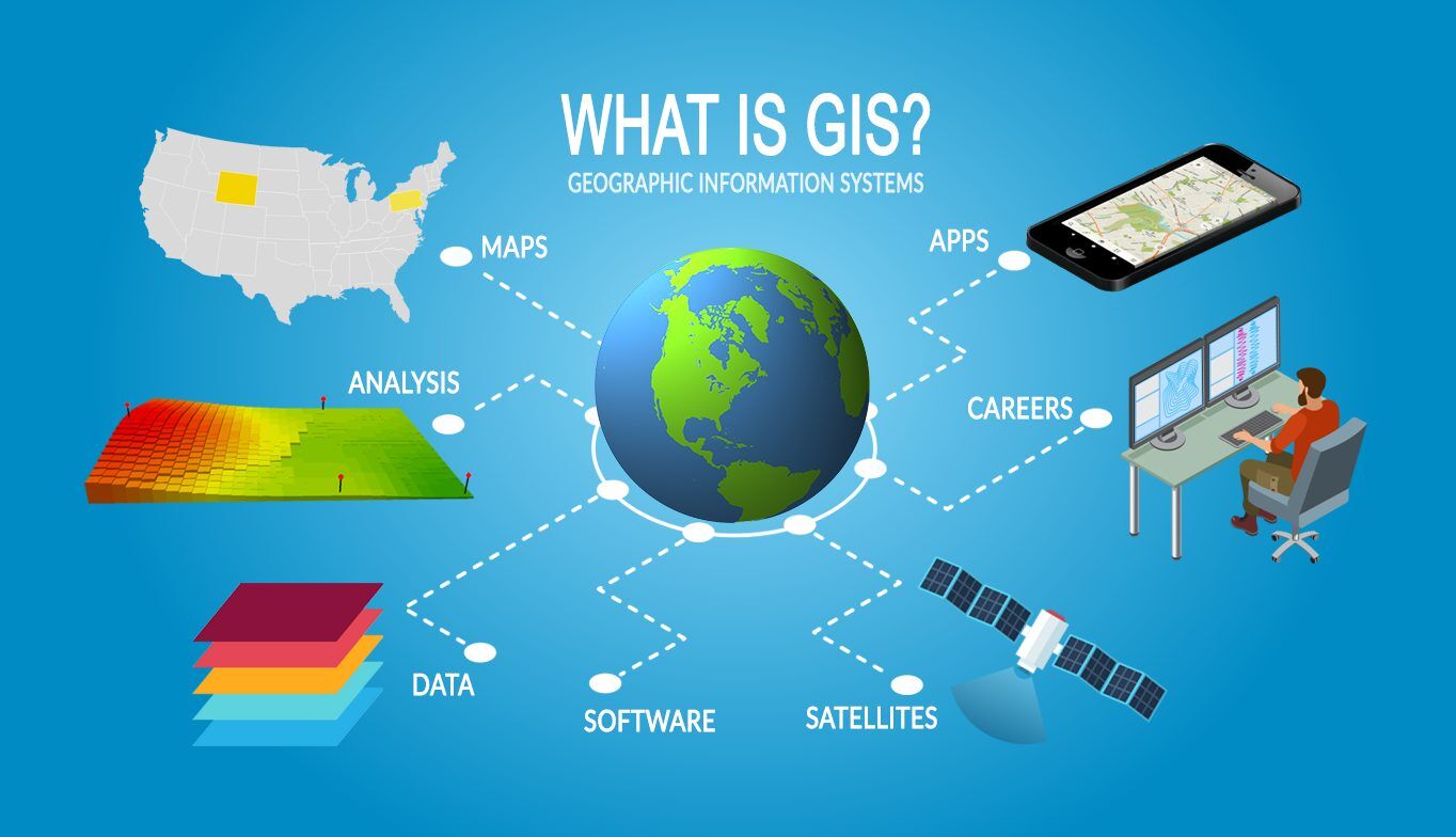
The Geographical Information System (GIS) has evolved since 1960 from a concept and rudimentary tool to a powerful database used to create, analyze, and problem solve. The field of GIS began in 1960 and was first used to create an inventory of Canada's natural resources in an online form. Which helped Canada start its National Land-use management program. Now GIS is an information system, a database “designed to capture, store, analyze, manipulate, and present various types of geographical data. The data provided by GIS can then be used to create strategic business maps for sales routes, franchise territories and more”. This incredible software can be used to create a plethora of map types such as: category maps, quantity maps, bubble maps, and heat maps. Each of these have their own uses to analyze and solve problems in the world. GIS has proven itself so useful that entire careers are dedicated to using it (Climate Scientist, Conservationist, Forester, etc…)

Many fields are utilizing the technology for a wide variety of purposes. Those fields include Archeology, Healthcare, City planning, Land use planning, Real Estate, Transportation, Insurance, and Criminal statistics:
- Predicting historic site locations
- Managing resources, analysis of cancer services
- Mapping where crimes happened at a specific time and area to analyze correlations
- Helping make the best decisions for land use
- Mapping damage from the aftermath of natural disaster
How Emergency Managers use GIS
The field of emergency management has been especially improved with the use of GIS. For example, when looking at how oil spills affect marine life, scientists used GIS to document the geological extent of the oil spill. They also track oil levels in the water, sediments, air, and prey. In Virginia, maps for coastal flooding were created depicting predicted sea level rises in the coming years and the impact it will have on the land. Helicopter firefighters even use GIS in the air to map incidents and share on the ground to help in the response.
During hurricane Katrina GIS technology helped deploy personnel, assign equipment, organize inventories, evacuate communities, model damage, and repair and restore infrastructure. Search and rescue used GIS maps to locate populated areas where people might have taken shelter. Medical staff used it to set up areas to provide medical care. Public health staff could track potential outbreaks of disease. Public works departments could get water, sewer, and other city services up and running. Mobile mapping was used to quickly disperse information to the public of shifting conditions in the field.

Different Types of GIS
There are several types of GIS software each that make it easier for the user to complete their job. Desktop GIS is used for creating, editing, visualizing, managing, and analyzing geographic data. This software is good for a wide variety of projects. Web GIS is a far more accessible and cheaper version that is good for interacting with maps on any device at anytime, anywhere. Server GIS is mostly used for large scale mapping and very specific tasks. This software is more advanced and among the more difficult versions to use. Then there are specialized GIS systems that are similarly difficult and serve very specialized needs in niche areas.
“The Internet has totally changed the GIS world. It’s no longer just the preserve of the experts and enterprise. The best part? Using a Web GIS to create incredible data-rich web maps — that can be shared with anyone, anywhere, on any device — takes just minutes.”
Providing Solutions for Emergency Managers
Just like GIS, ProPac has been aiding Emergency Managers for years. We provide the highest quality supplies possible for emergency and disaster response across the country. Over 800 disaster preparedness products can be found in our online store, click here to take a look for yourself!